
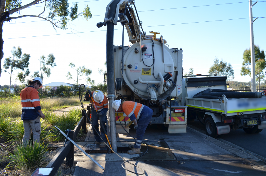
Waterway Projects

Council is committed to protecting our natural environment by improving the health of our waterways. We are actively working towards this through the delivery of on-ground projects, data collection and education initiatives.
If you own a residential or business property in Camden, you probably contribute to the Stormwater Levy that helps fund some of these projects that better our waterways.
Creek Restoration Project Elizabeth Macarthur Reserve
Camden Council partnered with Sydney Water and Downer BMD Joint Venture to remove weeds and restore native vegetation along the creek line within Elizabeth Macarthur Reserve, Camden South.
What did the area look like before?
Infestation of woody weeds led to degraded habitat quality and increased the susceptibility of stream banks to erosion and instability.
The riparian vegetation along the creek lines within Elizabeth Macarthur Reserve were made up of exotic species that have been introduced to Australia including many weed species such as African Olive (Olea europea subsp. cuspidata), Box elder Maple (Acer negundo), Chinese Celtis (Celtis cinensis), Privet (Ligustrum sp.) and Honey Locust (Gleditsia triacanthos).
What works were completed?
Mechanical weed removal and follow up maintenance weeding was undertaken to prepare the site for the planting of 3,000 native species of grasses, shrubs, and trees from the original pre-European River-Flat Eucalypt Forest plant community.
The weeds removed were mulched and left in place on the bank to prevent erosion and the regrowth of weeds.
The works were completed in August 2023 following a community planting event on National Tree Day that attracted 100 community volunteers, in addition to planting by the Kings Bush Bushcare Group and the Camden Council Staff Bushcare Group.

Site Location- pink areas show the extent of the project work.
How can I help?
You can join Council’s Bushcare program. Led by an experienced and qualified supervisor, the Kings Bush Reserve group meets at Chellaston Street, Camden each Tuesday and on the first Sunday of the month from 9am – 12pm. No experience or tools are required.
Bushcare is a great way to stay fit, meet new people and contribute to your local environment.
What is riparian vegetation?
The plants that are found along waterways are also known as riparian vegetation. This vegetation is important as it helps to stabilise the bank of the waterway, slowing the flow of stormwater, preventing erosion, and filtering out pollutants. It also provides food and habitat for both land and water-based animals including birds, fish and frogs and provides a corridor that allows connectivity of plants and animals. The shade from vegetation can help to stabilise the water temperature and reduce the likelihood of algal blooms.
What is River-Flat Eucalypt Forest?
River-Flat Eucalypt Forest is recognised as an Endangered Ecological Community under state and national environmental legislations and has been in decline due to pressures of land clearing, grazing and invasive plant and animal species. While forests were found across coastal floodplains and river flats in NSW and Victoria, there is now less than 30% of the original area remaining. This vegetation community has an important function in the Nepean River biodiversity corridor by supporting local ecosystems and the surrounding landscape.
Some of the most notable species in this community are:
- Forest Red Gum (Eucalyptus tereticornis);
- Cabbage Gum (Eucalyptus amplifolia);
- Rough-barked Apple (Angophora floribunda); and
- Broad-leaved Apple (Amplifolia subvelutina).
The iconic Camden White Gum (Eucalyptus benthamii) is also a local threatened species associated with this community.
| Before- May 2023 | After- October 2023 |
 |
 |
 |
 |
Funding
This project is proudly funded by Camden Council, Sydney Water and Downer BMD Joint Venture.
Who can I contact if I have any questions?
For more information about the project or to register your interest for Bushcare, contact Council’s Natural Resources Project Officer on 13 CAMDEN or email bushcare@camden.nsw.gov.au.
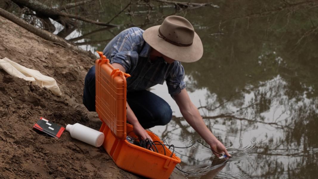
Hook, Line and Measure
Hook, Line & Measure is a new citizen science project developed by Council that encourages the community to identify and record the species, size and distribution of fish caught and observed in the Nepean River and other local waterways in the Camden area.
This project helps the community to identify areas for recreational fishing activities and assists Council in collecting baseline data to better understand our waterways and inform the delivery of future waterway projects.
To contribute to the project or view the dashboard, visit the Hook, Line & Measure webpage.
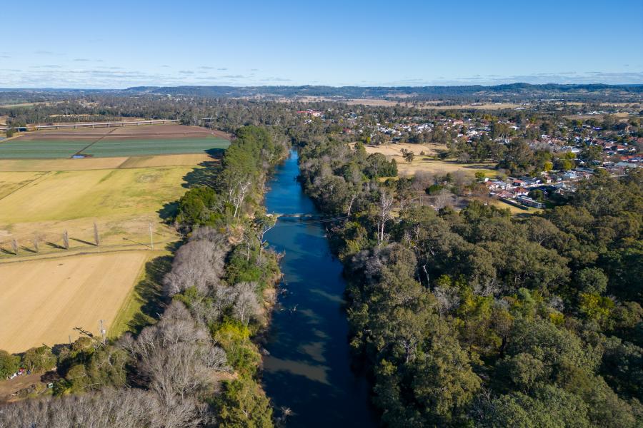
Nepean River Bank Stabilisation Project - Fergusons Land
Council entered into an agreement with Sydney Water to deliver a bank stabilisation project along a section of the Nepean River at Fergusons Land Cricket Facility. The project is part of a pilot project to offset nutrients released into the environment from Sydney Water’s wastewater treatment plants.
What did the area look like before?
The project site covered an area up to 200 metres along the Nepean River within the Fergusons Land Cricket Facility, located off Exeter Street, Camden.
This site was selected as it had experienced severe erosion, with some parts experiencing more than 30 metres of riverbank retreat since 2016. Measurements showed that more than 13,700 cubic metres of soil was lost between December 2021 and July 2023 due to the impacts of flood events. That’s enough material to fill almost five and a half Olympic sized swimming pools!

Site Location- the blue areas show the extent of the project work.
What works were completed?
The on-ground component of these works were completed mid-October 2023 and involved:
- Ecologist surveys;
- Removal of almost 6 tonnes of flood debris;
- Removal of approximately 10,000 m2 of woody weeds including African Olive (Olea europaea subsp. cuspidata), Honey Locust (Gleditsia triacanthos), and Broad-leaved and Small-leaved Privet (Ligustrumsp.);
- Earthworks to obtain a more stable gradient, maintain flood conveyance and reduce erosion caused by overland flow;
- Installation of two engineered log jams, two natural timber revetments, and three timber structures preventing bank toe erosion;
- Installation of rock ballast, log structures and timber pins along the bank face secured with marine grade steel cabling;
- Planting of 27,000 native plants from the Endangered Ecological Community of Cumberland River-Flat Eucalyptus Forest, including 25 critically endangered Camden White Gums (Eucalyptus benthamii); and
- Installation of herbivore-proof fencing.
Timber for the project was sourced from the Transport for NSW M12 project. This provided a great opportunity to effectively reuse waste as part of a best practice riparian restoration project.
How will these works help the Nepean River?
The bank stabilisation works at Fergusons Land will provide numerous benefits to the Nepean River including:
- Reduced erosion and soil lost from the Fergusons Land bank;
- Reduced nutrients entering the Nepean River during storm and flood events;
- Replacement of woody weeds with native vegetation from the Endangered Ecological Community of River-Flat Eucalyptus Forest which provide better biodiversity value, stabilise the soil, and provide resistance during flood events;
- Protection against overland flows draining from Fergusons Land;
- Reduced flow and erosive potential of flood waters across the bank; and
- Improved fish habitat and habitat for other aquatic and terrestrial species.
This best practice riparian restoration project was led by NSW Soil Conservation Service.
| Before- April 2022 | After- January 2024 |
 |
 |
 |
 |
Funding
Sydney Water fully funded the restoration of the 200-metre section of eroded and degraded riverbank within the Fergusons Land site. Sydney Water will continue to undertake maintenance and monitoring of the project site for 10 years.
Who can I contact if I have any questions?
For more information about the project, contact Council’s Catchments Project Officer on 13 CAMDEN or sustainability@camden.nsw.gov.au.
Additional Resources
Nepean River Bank Stabilisation Project - Rotary Cowpasture Reserve
What did the area look like before?
The Nepean riverbank was damaged by the flooding events of 2022. To prevent further erosion, Camden Council is undertaking bank stabilisation works at four locations along the bike path at Camden. The project will be completed in two stages; with Rotary Cowpasture Reserve now complete, and Belgenny to Chellaston expected to be complete by December 2024

What works were completed?
Some works at Rotary Cowpasture Reserve were completed in late-December 2023 and included:
- Bank stabilisation and erosion control;
- Addition of large woody debris as fish habitat;
- Removal of weeds including African Olive (Olea europaea subsp. cuspidata) and African Lovegrass (Eragrostis curvulata);
- Planting with local native species from the Endangered Ecological Community of River-Flat Eucalypt Forest to stabilise the bank and provide habitat; and
- Maintenance of the plants, including watering as required.
What works are outstanding?
The surrounding riparian corridor will undergo weed removal and replanting in mid- 2024. This will result in minor noise and temporary disruptions to pedestrian traffic as vehicles access the site from Rotary Cowpasture Reserve. All works will occur between 7am and 5pm Monday to Friday, and 7am and 1pm on Saturdays, with no work on Sundays.
Funding
Funding for this project was assisted by NSW Government through its Environmental Trust and funded under the joint Australian Government – NSW Government Disaster Recovery Funding Arrangements 2018.
Who can I contact if I have questions?
If you would like more information about this project or our local waterways, call Council’s Sustainability Team on 13 CAMDEN or email sustainability@camden.nsw.gov.au
Additional resources
Project Flyer – Bank Restoration – Rotary Cowpasture Reserve
Review of Environmental Factors – Bank Restoration – Rotary Cowpasture Reserve
Nepean River Bass habitat at Spring Farm
To support Camden residents’ desire to fish on the Nepean River, Camden Council installed fish habitat structures and erosion control measures to promote the increase in population and passage of Australian Bass.
What did the area look like before?
The Nepean riverbank near Burrell Street, Spring Farm was heavily degraded by impacts from flooding, overland flow, and inappropriate vehicular access.
The existing bushland was of high-quality River-Flat Eucalyptus Forest. After flooding in 2021, the bank experienced mass failure and weeds began to establish.
What works were completed?
The project works were completed in August 2023 and included:
- Earthworks to obtain a more stable gradient, maintain flood conveyance and reduce erosion caused by overland flow;
- Bank stabilisation and erosion control;
- Addition of large woody debris as fish habitat;
- Removal of weeds, such as balloon vine (Cardiospermum grandiflorum);
- Planting over 2,600 native plants to stabilise the bank, provide habitat and help restore the Endangered Ecological Community of River-Flat Eucalyptus Forest.
Timber and rock for the project was sourced from the Transport for NSW M12 project. This provided a great opportunity to effectively reuse waste as part of a best practice riparian restoration project.
What are snags and why are they important?
Snags, also known as large woody debris, are trees, branches and root masses that end up in rivers from floods, bank erosion, wind, or limb shedding. This natural process provides important habitat for aquatic life, especially native fish which rely on snags for refuge during fast river flows, shelter from predators, as landmarks for navigation, to define territories, as ambush sites, and for hosting eggs during breeding.
Snags are also important for water bugs which live amongst the wood and feed on the wood or on the microbes and algae growing on it. The sensitive water bugs that rely on these habitats are essential indicators of good water quality.
These woody structures are also used by reptiles, amphibians, insects, and birds. They are also important in improving the hydraulic diversity of the river, and in providing bank toe protection and stability.
Why is vegetation important?
Vegetation is important for stabilising banks, providing habitat for land-based and aquatic animals, and providing shade to water. Did you know that over 40% of the Australian Bass diet can come from insects falling off overhanging vegetation?
Some facts about Australian Bass (Macquaria novemaculeata):
- Usually reside in freshwater rivers, lakes and streams and migrate to estuarine waters to spawn;
- Are found in south-eastern coastal rivers;
- Eat fish, crustaceans and other invertebrates and are considered general purpose carnivores;
- Can be up to 4kg in weight and 65cm in length; and
- Are very popular for recreational fishing.
| Before- May 2023 | After- June 2023 |
 |
 |
 |
 |
Community Planting
The community assisted the rehabilitation of the site by planting 1,500 native plants local to the Endangered Ecological Community River-Flat Eucalyptus Forest. The “Plant Trees to Help Fishies” event had 55 volunteers and had three Camden SEED Network schools participate in colouring in the cardboard tree guards.
 |
 |
 |
 |
How can I help?
There are many ways you can help the success of this fish habitat project.
- Keep your vehicles out of Council’s reserves and bushland. Vehicles cause damage to natural areas by compacting the soil and preventing root migration, strip the surface off grasses and soil stabilising plants, introduce pollutants into the natural environment, and cause channelisation from wheel ruts.
- Join Council’s Bushcare program. There are groups located in Spring Farm and along the Nepean River.
- Be a responsible fisher
- Participate in citizen science through Hook, Line & Measure
- Plant native species in your garden
- Ask your school to be part of the Camden SEED Network to be the first to know about revegetation projects.
Funding
Funding for this project was assisted by NSW Department of Primary Industries Fisheries’ Recreational Fishing Trust’s “Habitat Action Grant Program”, which is financed from funds generated through collection of the recreation fishing licence fee in NSW.
Who can I contact if I have any questions
For more information about the project, contact Council’s Catchments Project Officer on 13 CAMDEN or sustainability@camden.nsw.gov.au.
Additional resources
Final Concept Design - Nepean River Bass habitat at Spring Farm
Project Flyer - Nepean River Bass Habitat at Spring Farm
Review of Environmental Factors - Nepean River Bass Habitat at Spring Farm